
Despite forecasts warning of unsettled weather, certain areas of Abu Dhabi remained dry, leaving some residents wondering why they did not experience the rainfall predicted across parts of the emirate.
No Rain in Some Parts of Abu Dhabi Despite Weather Alerts: Here’s Why.

The National Centre of Meteorology has clarified why inland parts of Abu Dhabi experienced thunderstorms, rainfall and dusty weather while central areas remained mostly dry, with forecasts suggesting additional showers and strong, dust-carrying winds could affect the region in the days ahead.
Why Some Parts of Abu Dhabi Saw Little Rain Despite Weather Warnings
For many people living in Abu Dhabi, Friday’s weather warnings may have appeared somewhat puzzling. Reports of thunderstorms, rainfall, powerful winds and dusty conditions were coming from different parts of the emirate, while authorities took precautionary measures at some public locations. Yet, in central Abu Dhabi, including areas around the Corniche, the weather appeared comparatively unchanged.
Instead of experiencing the rain and thunderstorms reported elsewhere, residents in the capital largely encountered the familiar conditions associated with the summer season. The atmosphere remained humid and hot, while dusty or hazy skies continued to dominate the view. The sea along the Corniche also appeared greyish under the hazy conditions, giving little indication that other parts of the emirate were experiencing more active weather.
The difference in conditions across relatively nearby areas was linked to the location and movement of the weather system affecting Abu Dhabi, according to the National Centre of Meteorology (NCM).
Maryam Al Shehhi, head of marine meteorology at the NCM, explained that the weather activity on Friday was concentrated mainly over inland and southern parts of the emirate rather than directly over Abu Dhabi city.
This meant that while some areas were under the influence of developing storm clouds and rainfall, central Abu Dhabi remained largely outside the most active part of the system.
Why the weather differed across Abu Dhabi
Weather conditions can vary considerably across the same emirate, particularly during the summer months. Rainfall does not necessarily spread evenly across a large area, and thunderstorms can develop over one location while nearby areas experience little or no precipitation.
According to Al Shehhi, the summer weather systems affecting the UAE commonly approach from the east and southeast. This makes areas closer to Al Ain and the mountain regions particularly important in the development of convective clouds.
These areas can experience the initial stages of cloud development when atmospheric conditions become unstable. As the clouds grow, they can produce showers, thunderstorms, strong winds and dust in the surrounding regions.
However, the resulting weather does not always extend as far as the capital. Depending on atmospheric conditions, the strongest activity may remain concentrated inland, leaving coastal and central parts of Abu Dhabi with much less noticeable change.
Heat and humidity help build storm clouds
One of the main factors behind summer thunderstorms is the combination of strong surface heating, moisture and instability in the atmosphere.
During the hotter months, intense sunlight heats the land significantly. At the same time, high humidity provides a plentiful supply of moisture. When much colder air exists higher in the atmosphere, the contrast between the hot surface and cooler upper levels can create unstable conditions.
Under these circumstances, warm and moist air near the ground can rise rapidly. As it moves upward, the moisture can condense and contribute to the development of tall clouds.
These clouds can continue growing when the atmospheric conditions remain favourable. Eventually, they may become large enough to produce rainfall, lightning and thunder.
The process can be highly localised. A strong thunderstorm may develop over an inland area while a location only a relatively short distance away receives no measurable rain.
This helps explain why residents in different parts of Abu Dhabi can experience completely different weather on the same day.
Inland areas are more likely to see active weather
The areas around Al Ain and the eastern parts of the UAE can play an important role in summer cloud development because of their geographical setting and proximity to mountainous terrain.
When hot and humid air interacts with cooler air at higher elevations, atmospheric instability can increase. The mountains can also influence the movement and upward development of air, helping clouds to grow under suitable conditions.
As convective clouds develop over inland areas, they can bring rainfall and thunderstorms to those locations. Strong downdrafts associated with storms may also produce powerful winds.
Those winds can lift loose dust from the ground, reducing visibility and creating dusty conditions in affected areas.
This can result in a combination of weather phenomena occurring at the same time, including rain, thunder, lightning, strong winds and blowing dust.
However, the presence of such conditions inland does not automatically mean that central Abu Dhabi will experience the same weather.
Why downtown Abu Dhabi remained relatively dry
Abu Dhabi city is located on the coast, and its weather can differ from conditions farther inland.
On Friday, the most active part of the weather system remained concentrated away from the city centre. As a result, residents in areas such as the Corniche did not experience the same level of rainfall or thunderstorm activity reported in other parts of the emirate.
Instead, the city continued to experience humid conditions and hazy or dusty skies.
For residents accustomed to Abu Dhabi’s summer weather, the conditions may therefore have seemed relatively normal despite the warnings being issued across the emirate.
Weather warnings are generally designed to alert people to potentially hazardous conditions across affected areas. They do not necessarily mean that every neighbourhood within the warning area will experience identical weather.
Thunderstorms are particularly difficult to distribute evenly because they are created by local atmospheric processes. A storm can develop rapidly in one location and weaken before reaching another.
Rainfall can be highly localised
One of the most important characteristics of thunderstorms is their local nature.
Unlike widespread weather systems that may bring continuous rain across a broad region, convective storms can form in isolated areas. A particular neighbourhood may receive heavy rainfall while another location nearby remains completely dry.
This is why residents may see videos or reports of intense rainfall from another part of Abu Dhabi while experiencing no rain outside their own homes.
The difference does not necessarily mean that the forecast was incorrect. Instead, it reflects the difficulty of predicting the exact location, timing and intensity of individual thunderstorms.
Meteorologists can identify conditions that are favourable for storm development and forecast areas where rainfall is possible. However, the precise path of each developing cloud system can depend on several atmospheric factors.
The role of upper-level temperatures
The difference in temperature between the surface and upper atmosphere is another important element in storm development.
During the summer, the land surface can become extremely hot. If significantly cooler air is present higher up, the atmosphere can become unstable.
Warm air tends to rise, and when that air contains substantial moisture, it can support the development of towering clouds. As the clouds grow vertically, they can produce strong upward and downward air movements.
Eventually, these clouds may generate heavy showers, thunder and lightning.
Where the necessary combination of heat, moisture and cooler upper-level air is absent or weaker, cloud development may be limited.
This can leave coastal areas with hot and humid conditions while inland areas experience much more active weather.
Dust can travel beyond rainfall areas
Dust is another reason residents may notice signs of unsettled weather even when they do not receive rain.
Strong winds generated by thunderstorms can lift dust and sand from dry surfaces. Once airborne, the particles can be carried across considerable distances.
As a result, a dusty or hazy sky in Abu Dhabi city does not necessarily mean that a thunderstorm is directly overhead. Dust from more active weather elsewhere can affect visibility and the appearance of the sky in areas that remain dry.
This may explain why downtown residents saw dusty white or greyish skies despite not experiencing the rainfall reported in inland parts of the emirate.
The movement of dust can also make conditions appear unsettled even when there is little precipitation at ground level.
Coastal and inland weather can contrast
The difference between coastal and inland conditions is not unusual in the UAE, especially during periods of summer instability.
Coastal areas are strongly influenced by the surrounding sea and the associated moisture and humidity. Inland areas, meanwhile, can experience much stronger surface heating during the day.
The combination of these factors can contribute to significant differences in atmospheric conditions across relatively short distances.
The mountains and elevated terrain in the eastern part of the country can further influence cloud development.
As a result, residents in Abu Dhabi city should not necessarily expect the same weather experienced in Al Ain or areas closer to the mountains.
Weather warnings remain important
Even when some residents see little change in their immediate surroundings, official weather warnings remain important.
A warning is intended to help people prepare for possible hazardous conditions rather than guarantee that every location will experience the forecast weather.
Conditions can also change quickly. A location that is dry in the morning may experience rain or strong winds later if a storm develops nearby or moves towards it.
For this reason, residents are encouraged to continue monitoring official weather updates, particularly when authorities issue alerts for thunderstorms, heavy rain, strong winds or reduced visibility.
Drivers should also remain cautious when travelling between areas with different weather conditions.
A journey that begins under clear or hazy skies in central Abu Dhabi could eventually encounter heavy rain, strong winds or dust farther inland.
What residents can expect
The weather pattern described by the NCM is part of the broader summer weather cycle in the UAE. Strong daytime heating, abundant moisture and atmospheric instability can create favourable conditions for convective clouds, particularly over eastern and inland areas.
These conditions can lead to isolated or scattered thunderstorms rather than uniform rainfall across the entire emirate.
Some residents may therefore experience a dramatic change in weather while others continue to see familiar summer conditions.
The contrast between Abu Dhabi city and inland locations on Friday was an example of this pattern.
While some areas recorded rain and thunderstorms, residents along the Corniche largely experienced humidity, heat and haze.
More unsettled conditions possible
The weather situation can continue to evolve over the following days, and residents should pay attention to updated forecasts from the NCM.
When atmospheric conditions remain favourable for cloud development, additional showers, thunderstorms, strong winds or dust may occur in some areas.
The exact locations affected can vary from one day to another.
Residents should therefore avoid assuming that conditions experienced on one day will necessarily repeat in the same location the following day.
The most useful approach is to follow the latest official forecast and advisories for the specific area in which they live or plan to travel.
Understanding the apparent mismatch
For people who received weather alerts but saw no rainfall, the explanation is largely connected to the localised nature of summer thunderstorms.
The warnings reflected the potential for unsettled conditions across affected parts of Abu Dhabi, while the most active weather on Friday was concentrated over inland and southern areas.
Central Abu Dhabi remained comparatively unaffected because the developing storm clouds did not produce the same level of activity over the city.
The situation demonstrates why weather can look dramatically different across the UAE at the same time.
One location can experience heavy rain and thunder while another remains dry under hazy skies.
According to the NCM, the summer pattern is influenced by weather systems arriving from the east and southeast, with areas around Al Ain and the mountains providing favourable conditions for convective cloud development.
Strong surface heating, high humidity and cooler air higher in the atmosphere can combine to create instability, allowing clouds to build rapidly.
When those clouds mature, they can produce rainfall, thunderstorms and strong winds. The associated winds can also lift dust, creating hazy conditions over a wider area.
For Abu Dhabi residents, this means that a lack of rain in the city does not necessarily contradict a wider weather warning.
The forecast may apply to a broader region where conditions vary considerably from one location to another.
As summer weather systems continue to develop, residents should remain attentive to official updates and avoid relying solely on what they observe outside their own homes.
The key takeaway is that rainfall and thunderstorms in the UAE can be highly localised. The presence of severe weather inland does not guarantee rain in downtown Abu Dhabi, just as dry conditions in the capital do not mean the entire emirate is experiencing stable weather.
For residents, following NCM forecasts and safety advisories remains the best way to stay informed about changing conditions, particularly when thunderstorms, heavy rainfall, strong winds or dust are expected.
Why Rainfall Varies Across Abu Dhabi
Weather conditions associated with summer thunderstorms can be highly uneven, with one part of Abu Dhabi receiving heavy rain and strong winds while another area remains mostly dry. This variation is largely linked to where atmospheric instability develops and how far the resulting cloud systems travel.
According to Maryam Al Shehhi, head of marine meteorology at the National Centre of Meteorology, the low-pressure pattern that commonly develops during the UAE’s summer months is usually strongest near the Earth’s surface. It is less frequent for the same feature to continue through the higher levels of the atmosphere.
When the lower and upper atmospheric conditions combine in the right way, however, the environment can become considerably more unstable. This creates favourable conditions for powerful clouds to develop rapidly, sometimes resulting in thunderstorms, rainfall, lightning and strong winds.
The uneven distribution of these conditions is one reason residents across Abu Dhabi can experience dramatically different weather on the same day.
How thunderstorms develop
During summer, intense heat at the Earth’s surface warms the air close to the ground. When that air contains sufficient moisture and encounters cooler air higher in the atmosphere, it can become unstable.
Warm, moist air rises, and as it moves upward it can contribute to the formation of large convective clouds. If the atmospheric environment continues to support upward movement, these clouds can grow rapidly.
Once the clouds become sufficiently developed, they can produce showers, thunderstorms and strong gusts. However, the process does not necessarily happen uniformly across the emirate.
The atmospheric ingredients may come together strongly over one location while remaining weaker elsewhere. This creates the possibility of intense rainfall in one area and little or no precipitation just a short distance away.
Why rain and dust can occur together
The same thunderstorms that produce rainfall can also trigger sudden dusty conditions.
As rain falls from a developing storm cloud, strong currents of air can move downward from the cloud towards the surface. These downdrafts can become powerful and spread outward once they reach the ground.
When the descending air reaches the surface, it can push outward in different directions. The strong movement of air can lift loose dust and sand from the ground, creating a rapid increase in airborne particles.
This can result in a noticeable shift in visibility and sky conditions around the storm.
Residents may therefore see a dark rain cloud approaching and then suddenly experience strong winds and dusty or hazy conditions as the storm passes.
The dust is not necessarily caused by the rainfall itself. Instead, the powerful air movement associated with the storm can disturb dry material at the surface and carry it into the atmosphere.
Downward air movement creates strong gusts
Al Shehhi explained that these storm-related air currents differ from ordinary winds that primarily move horizontally across the surface.
In the early stage of the process, the air is descending vertically from the cloud. Once it reaches ground level, it spreads outward.
This change in direction can generate strong gusts that move away from the storm.
The resulting winds can be felt some distance from the centre of the rainfall and may also transport dust into nearby areas.
This helps explain why residents may experience a sudden burst of wind and dust even when rainfall is limited or has not yet reached their immediate location.
Inland areas often see more summer storms
Summer rainfall is generally more common in inland and eastern parts of the UAE, particularly around Al Ain and areas close to the Hajar Mountains.
The geography of these regions can encourage the upward movement of warm air and support the formation of convective clouds when the wider atmospheric conditions are favourable.
The mountainous terrain can play an important role in cloud development, particularly during the warmer months when surface temperatures are high.
As a result, areas around Al Ain and the eastern mountain regions can experience thunderstorms and showers before similar activity reaches farther west.
However, the weather system can sometimes extend beyond these areas and affect inland parts of Abu Dhabi emirate.
Abu Dhabi’s inland communities can also be affected
Within Abu Dhabi emirate, summer rain is not limited to the far eastern parts of the region.
When the atmospheric system develops far enough westward, locations such as Mohamed bin Zayed City, Shakhbout City, Al Shamkha and Al Shawamekh can experience rain and thunderstorms.
Other inland communities can also be affected depending on the direction and development of the weather system.
The distance between these locations and central Abu Dhabi can make the difference in weather particularly noticeable.
A resident in one part of the emirate may receive warnings about thunderstorms while another resident nearby sees only cloudy or hazy conditions.
This is a normal characteristic of convective summer weather, where individual storm cells can be relatively concentrated.
Al Dhafra and Liwa can also receive rain
The western and southwestern parts of Abu Dhabi emirate can experience summer rainfall as well.
The Al Dhafra region, including areas around Liwa, can be affected when weather systems move westward from the south.
The precise area receiving rainfall depends on the movement and development of the atmospheric system.
This means that rainfall can sometimes reach locations that would not normally be associated with the most active summer storm activity.
However, the distribution remains highly variable. One area can receive a significant shower while another nearby location remains dry.
Why the difference can be so noticeable
The variation in weather can be striking for residents because Abu Dhabi emirate covers a large geographical area.
People living only several dozen kilometres apart can experience very different conditions.
One community may see lightning, thunder, strong winds and heavy rainfall, while another may continue to experience humid conditions with dusty or hazy skies.
The difference is not necessarily an indication that the weather forecast was inaccurate. Rather, it reflects the localised nature of thunderstorms.
Forecasts can identify a region where atmospheric conditions are favourable for rain, but the exact location of each storm can be difficult to determine with complete precision.
This is particularly true for convective weather, which can develop quickly in response to local changes in temperature, moisture and atmospheric stability.
Timing of rainfall also varies
Another factor contributing to differences between locations is the timing of storm development.
Summer rain does not necessarily begin at the same time across the UAE.
Eastern and mountainous areas can experience convective activity relatively early in the day because of the way the terrain responds to strong heating.
Higher ground can warm during the day and encourage air to rise. As this process continues, clouds can develop and eventually produce showers or thunderstorms.
Inland areas farther west may experience the same process later.
Why the mountains can see rain earlier
The eastern mountain region has geographical characteristics that can encourage convection.
As the sun heats the land, air near the surface becomes warmer and begins rising. The elevated terrain can support this upward movement, helping clouds to develop when moisture and atmospheric instability are sufficient.
Because this process can begin earlier in the day, thunderstorms may appear over mountainous areas before similar activity develops farther inland.
The resulting clouds can then change as they move, weaken or strengthen depending on the conditions they encounter.
This is one reason residents in eastern areas may see rain while Abu Dhabi city remains dry during the same afternoon.
Inland rainfall may take longer to develop
For Al Ain and inland areas of Abu Dhabi, the development of rain can occur later as the surface continues to heat.
The ground needs to become sufficiently warm to provide the upward movement required for convection.
According to Al Shehhi, this process takes time. The air can continue rising as the land heats until the atmosphere reaches a point where convective clouds can form and grow.
Once the necessary conditions are established, cloud development can accelerate relatively quickly.
This means that residents may experience a long period of hot and humid weather before suddenly seeing clouds build and rainfall begin.
Friday’s rainfall developed later
The weather on Friday provided an example of this timing difference.
In some locations, rainfall began at around 6.30pm, after the ground had accumulated enough heat to support the rising air associated with convection.
For residents waiting for rain after seeing earlier weather warnings, the delay may have seemed unusual.
However, the timing was consistent with the gradual development of the atmospheric conditions required for convective clouds.
The process begins with surface heating and rising air, followed by cloud formation once enough moisture and instability are present.
Only after the clouds become sufficiently developed can they produce significant rainfall.
Why a warning does not mean rain everywhere
Weather alerts are intended to communicate the potential for hazardous conditions over an affected area. They should not necessarily be interpreted as a guarantee that every neighbourhood will experience rainfall.
Thunderstorms are particularly difficult to distribute uniformly.
A storm may develop strongly over one inland community, weaken as it moves away or shift in another direction, leaving nearby areas with much less activity.
For this reason, residents may receive the same regional warning while experiencing very different conditions at home.
Local conditions matter
The development of summer thunderstorms depends on several factors working together.
Surface temperatures, humidity, upper-atmosphere temperatures, wind patterns and geography can all influence whether clouds develop and where they eventually produce rain.
Small differences in these conditions can change the location and intensity of a storm.
This is why meteorologists monitor atmospheric conditions continuously during periods when convective weather is expected.
What residents should expect
The weather pattern described by the NCM highlights the highly localised nature of summer rainfall in the UAE.
Residents in eastern and inland areas may experience storms earlier, while communities farther west can remain dry for several hours before clouds develop.
In some cases, the storm activity may never reach central Abu Dhabi.
Other days may see the system extend farther west, bringing rain to communities such as Mohamed bin Zayed City, Shakhbout City, Al Shamkha or Al Shawamekh.
The Al Dhafra region and areas around Liwa can also experience showers when the weather system moves in the appropriate direction.
A rapidly changing pattern
The development of convective clouds can be relatively rapid once the atmosphere becomes unstable.
This means conditions can change within a short period. A clear or hazy sky can quickly give way to towering clouds, strong winds and rain.
The reverse can also happen, with a storm weakening after a brief period of intense activity.
Residents should therefore remain attentive to official updates when unstable weather is forecast.
Understanding the rain-dust connection
The combination of rainfall and dust may also seem unusual to people unfamiliar with thunderstorm dynamics.
In reality, the two can be closely connected.
Strong downdrafts from storm clouds can reach the ground and spread outward, producing powerful surface winds. Those winds can lift dust and sand, creating hazy conditions around the storm.
As a result, residents may see dust increase shortly before, during or after a rain shower.
This phenomenon can also explain why dusty winds may be reported beyond the immediate area of rainfall.
Why Abu Dhabi can remain dry
Central Abu Dhabi may remain dry when the atmospheric instability and cloud development stay concentrated farther inland.
The city can still experience humidity, haze and dusty skies because of its coastal environment and the movement of airborne dust.
However, without sufficiently developed convective clouds directly overhead, significant rainfall may not occur.
This difference is why residents should consider weather information for their specific location rather than assuming that conditions elsewhere in the emirate will be identical.
The broader summer weather pattern
Summer thunderstorms in the UAE are influenced by a combination of heat, moisture and atmospheric instability.
The eastern mountains and inland regions are often among the first areas to see cloud development because local geography and surface heating encourage rising air.
As the day progresses, conditions can become favourable farther inland and, in some cases, farther west.
Whether rain ultimately reaches Abu Dhabi city depends on how the weather system develops and moves.
For residents, the key point is that rainfall can be extremely localised. A thunderstorm affecting one part of the emirate does not necessarily mean rain will arrive in every other area.
Friday’s conditions illustrated this clearly: some communities experienced thunderstorms, rain, strong winds and dust, while others saw little more than humid, hazy weather.
The timing can also differ significantly. Mountain areas may develop convective clouds earlier, while inland locations may need several more hours of surface heating before conditions become favourable.
As Al Shehhi explained, the atmosphere needs time to reach the right combination of heat, moisture and instability before powerful clouds can form.
Once that combination is established, conditions can change quickly, producing the dramatic thunderstorms and sudden bursts of rain and dust seen across parts of the UAE.
For residents, continuing to monitor NCM forecasts and official advisories is therefore important whenever unsettled weather is expected. Even if one area remains dry, conditions can evolve rapidly, and a weather system may strengthen, weaken or shift during the course of the day.
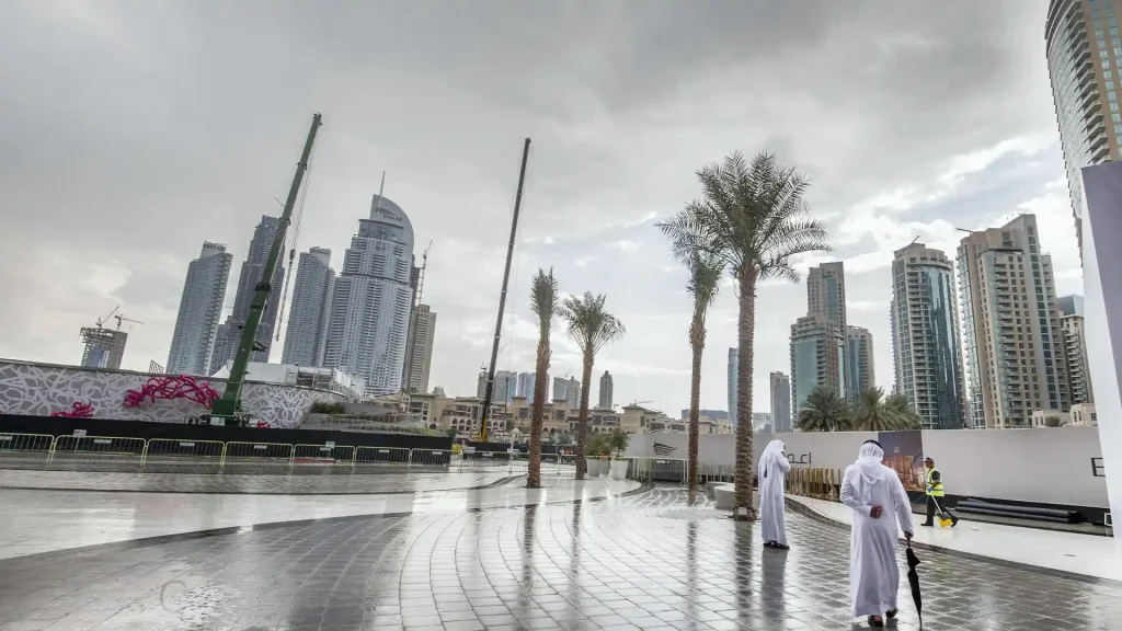
More Rain Could Arrive Across the UAE in the Days Ahead
The UAE’s unsettled summer weather pattern is expected to continue, with the National Centre of Meteorology forecasting further opportunities for rainfall and convective cloud development across parts of the country over the coming days.
Although rainfall during the summer can be highly localised, residents in eastern, southern and some western areas may see additional showers as atmospheric conditions remain favourable for cloud formation.
The latest outlook suggests that weather conditions will vary considerably from one location to another. Some areas may remain dry or partly cloudy, while others could experience afternoon cloud development accompanied by rain and stronger winds.
Saturday forecast
On Saturday, August 22, the weather is expected to range from fair to partly cloudy across the UAE.
During the afternoon, convective clouds could develop over eastern, southern and western parts of the country. Where these clouds become sufficiently developed, they may bring rainfall.
The possibility of convective cloud formation means conditions could change relatively quickly in affected areas. Residents in locations where clouds develop should remain alert to changes in wind, visibility and rainfall intensity.
Winds are expected to begin as light to moderate southeasterly to northeasterly breezes. At times, however, they may become considerably stronger.
Wind speeds could reach around 50km/h in some areas. Stronger gusts may lift loose dust and sand from the ground, resulting in blowing dust and reduced visibility.
For motorists, such conditions can make driving more difficult, particularly when dust combines with changing weather or rainfall. Drivers should remain cautious and follow any temporary road instructions issued by authorities.
Coastal locations may also experience humid conditions during the morning. There is a possibility of fog or mist forming over some coastal areas, which could temporarily reduce visibility.
Rain remains possible on Sunday
The chance of afternoon rainfall will continue into Sunday, with eastern areas again expected to be among the locations where convective clouds could develop.
The forecast indicates that winds could reach speeds of around 40km/h. Stronger winds may carry dust and sand, particularly over exposed inland areas.
The combination of cloud development, rainfall and stronger winds means weather conditions may vary significantly during the day.
Residents should therefore continue checking updated forecasts, particularly if they are planning outdoor activities or travelling between different parts of the UAE.
Conditions could remain unsettled on Monday
By Monday, convective cloud formation is again possible over eastern parts of the country.
While the forecast does not mean that every location will receive rain, the development of these clouds could result in showers in some areas.
As with previous days, rainfall is expected to remain localised. One area may receive a brief shower while another nearby location sees only clouds or remains completely dry.
This localised nature of summer rainfall is common in the UAE and can make conditions appear very different from one emirate or neighbourhood to another.
Tuesday may bring further showers
The weather could remain active on Tuesday, when rain-producing convective clouds may form over eastern and southern areas of the UAE.
Winds could reach around 40km/h, with stronger gusts potentially lifting dust and sand.
Residents in affected areas may notice hazier skies or reduced visibility as winds increase.
Motorists should take particular care when travelling during dusty conditions, especially if visibility drops suddenly.
More cloud development expected on Wednesday
The unsettled pattern may continue into Wednesday, with eastern and southern areas again potentially seeing convective clouds during the afternoon.
These clouds could be associated with rainfall, although the exact location and intensity of any showers will depend on how the weather system develops.
Winds may become stronger, reaching up to approximately 45km/h in some areas. The stronger winds could raise dust and sand, creating periods of reduced visibility.
Residents should remain prepared for changing conditions and monitor the latest weather information before travelling.
Sea conditions expected to remain relatively calm
Despite the possibility of rain and stronger winds over land, marine conditions are expected to remain slight in both the Arabian Gulf and the Oman Sea during the forecast period.
This means that, overall, sea conditions are not expected to become particularly rough under the current outlook.
However, people planning marine activities should still check the latest marine forecast and follow any official warnings if conditions change.
Humidity and morning mist
Some coastal areas could experience high humidity during the early hours of Saturday.
The forecast also includes the possibility of fog or mist developing in certain coastal locations.
Such conditions can temporarily reduce visibility, particularly during the morning. Drivers travelling along coastal roads should therefore remain alert and adjust their speed if visibility becomes limited.
Fog and mist can form under specific combinations of moisture, temperature and wind conditions, meaning they may affect some areas while leaving others clear.
Summer rain does not mean the desert will turn green
While the UAE may experience repeated summer showers in some areas, these rainfall events are generally not enough to transform the desert landscape into widespread greenery.
According to Maryam Al Shehhi, head of marine meteorology at the NCM, summer showers are often too short-lived and geographically limited to provide the continuous supply of moisture needed for vegetation to flourish.
For vegetation to become noticeably greener, the land requires more consistent rainfall over a longer period.
A brief, heavy shower can deliver a large amount of water in a short time, but that does not necessarily provide the same benefit as repeated light rainfall.
Why sustained rainfall matters
For plants and grasses to respond to rainfall, moisture needs to remain available in the soil.
When rain falls gently and repeatedly, water has more opportunity to soak into the ground and remain available to vegetation.
A short but intense storm can behave differently. Large amounts of water may fall rapidly, potentially running off the surface rather than remaining in the soil for an extended period.
Summer thunderstorms can therefore produce impressive rainfall totals in a short period without creating the sustained conditions required for widespread vegetation growth.
Al Shehhi described the type of rainfall needed for the landscape to become greener as lighter and more persistent rain.
Under such a pattern, clouds can pass over an area, produce gentle rainfall and then return again on subsequent days.
This repeated moisture supply is more beneficial to vegetation than an isolated downpour.
Recent rainfall has been widespread in some areas
The current rainfall pattern is also not simply a one-day event.
Al Shehhi said certain inland and eastern parts of the UAE have experienced rainfall with considerable frequency since around the middle of July.
Some areas have recorded rain on an almost daily basis during this period.
Al Ain has been among the locations receiving repeated showers, along with other inland areas and parts of the eastern and northern UAE.
Locations mentioned include Al Shawieb, Al Hayer, Al Madam, Al Dhaid and Falaj Al Mualla.
Some parts of the Al Dhafra region have also experienced rainfall during this period.
However, the repeated showers have not been evenly distributed.
Because summer thunderstorms are often highly localised, a location can experience frequent rainfall while another area relatively nearby receives very little.
Why Abu Dhabi city may see less rain
This localised pattern helps explain why residents in Abu Dhabi city may not notice the rainfall occurring elsewhere.
Thunderstorms can develop over inland areas while central Abu Dhabi remains dry.
Residents may see photographs or videos of heavy rain, lightning and thunderstorms from another part of the emirate and wonder why the same weather has not reached their neighbourhood.
The answer is that convective storms are influenced by local atmospheric conditions, including heat, moisture, wind patterns and geography.
A storm cell can remain concentrated over one area and weaken before reaching another.
Consequently, repeated rainfall in Al Ain or other inland locations does not necessarily mean central Abu Dhabi will receive the same amount of rain.
Rain can provide temporary relief from humidity
For residents dealing with Abu Dhabi’s characteristic summer combination of high heat and humidity, rainfall can bring a short period of relief.
The atmosphere can feel particularly uncomfortable before a summer shower. High temperatures combined with moisture in the air can create the heavy, oppressive sensation commonly associated with humid weather.
When rain arrives, conditions may temporarily feel more comfortable.
According to Al Shehhi, people can sometimes notice the air becoming slightly drier after rainfall.
The change may be relatively brief, but it can make the weather feel noticeably different for a short period.
Why the air feels different after rain
The sensation of relief after rainfall can be linked to changes in temperature and humidity around the rain event.
A shower can temporarily lower temperatures in the immediate area. Rain and associated downdrafts can also alter the movement and distribution of air near the surface.
As a result, the atmosphere may feel less oppressive than it did before the storm.
However, this improvement generally does not last for long during the UAE summer.
Once the rain moves away and the surface begins heating again, temperatures and humidity can rise.
Summer heat is expected to return
The temporary cooling associated with rainfall should not be confused with the arrival of cooler autumn conditions.
Temperatures are expected to increase again after the current period of slightly lower readings.
Al Shehhi noted that temperatures can continue to fluctuate through the remainder of August and into September before a more noticeable seasonal decline becomes apparent.
The UAE’s transition away from the peak summer heat happens gradually.
As the season progresses, temperatures typically begin to ease, but residents should still expect hot conditions for some time.
Saturday temperatures remain high
The latest NCM bulletin forecasts maximum temperatures on Saturday ranging from around 38°C to 43°C along the coast and islands.
Internal areas are expected to be considerably hotter, with maximum temperatures potentially reaching between 44°C and 48°C.
Mountain areas are forecast to remain comparatively cooler, with temperatures expected to range from approximately 33°C to 37°C.
These figures highlight the substantial temperature differences that can occur between coastal, inland and mountainous parts of the country.
Even where rainfall develops, the wider environment can remain very hot.
Rainfall and heat can occur together
The possibility of thunderstorms during the hottest part of the year may appear surprising, but the combination of intense surface heating and atmospheric moisture is one of the factors that can contribute to summer convection.
The land heats strongly during the day, causing warm air to rise. When sufficient moisture and instability are present, clouds can grow vertically and develop into rain-producing systems.
This means that rainfall does not necessarily signal a broad change towards cooler weather.
Instead, showers can occur within an otherwise very hot summer pattern.
What residents should expect
The coming days are likely to continue this mixed pattern, with some parts of the UAE seeing convective clouds and showers while other locations remain dry.
Eastern and southern areas appear more likely to experience cloud development, although western and inland areas can also be affected depending on how the weather system evolves.
Winds will occasionally become strong enough to lift dust and sand, potentially affecting visibility.
Residents should therefore remain prepared for sudden changes, particularly during the afternoon when convective clouds are most likely to develop.
Continue monitoring forecasts
Because summer thunderstorms can be unpredictable and localised, residents should keep checking updated NCM forecasts rather than relying only on a single daily prediction.
The exact location of rainfall can shift as clouds develop and move.
A forecast indicating rain in a particular region means there is potential for rainfall, but it does not necessarily mean every neighbourhood will receive a shower.
This is particularly relevant for Abu Dhabi, where residents in the city may experience very different conditions from those living in inland communities.
A mixed picture for the UAE
The weather outlook for the coming days presents a combination of heat, humidity, cloud development, rainfall and stronger winds.
Saturday is expected to bring possible afternoon showers in eastern, southern and western areas, while Sunday may again see rainfall over eastern locations.
Monday and Tuesday could bring further convective activity, with eastern and southern parts of the country remaining among the areas to watch.
Wednesday may continue the pattern, with eastern and southern areas again potentially experiencing afternoon clouds and rain.
At the same time, winds could periodically strengthen and carry dust and sand, while coastal areas may experience humid mornings and occasional mist or fog.
For residents, the key point is that the UAE’s summer weather remains highly variable. Some communities can receive repeated rainfall while others remain largely dry.
No immediate end to summer conditions
Even with the prospect of more rain, the UAE is still firmly within its hot summer season.
The forecast temperatures demonstrate that rainfall and thunderstorms are occurring against a backdrop of significant heat.
The most intense summer conditions are expected to gradually ease later in the season, but temperatures can remain high through August and into September.
For now, residents should be prepared for a combination of hot temperatures, humidity and occasional unsettled weather.
What the forecast means for residents
People living in areas where rainfall is expected should be prepared for temporary changes in road and outdoor conditions.
Stronger winds can raise dust, while rain can make surfaces wet and reduce visibility.
Those travelling should check the latest weather and traffic information before setting out, particularly if their route passes through areas where thunderstorms or blowing dust are forecast.
Residents planning outdoor activities should also remain flexible because weather conditions can change quickly when convective clouds develop.
At the same time, coastal residents should be aware that morning humidity, fog or mist can occasionally affect visibility even when no rain is occurring.
A summer pattern likely to continue
The latest forecast suggests that the UAE’s distinctive summer weather pattern will remain in place for at least the next several days.
Rainfall will continue to be concentrated in particular areas rather than spread evenly across the country.
For some inland and eastern communities, this could mean another series of afternoon showers. For residents in Abu Dhabi city and other drier areas, the weather may remain dominated by heat, humidity and haze.
The recent frequency of rainfall in areas such as Al Ain and other inland and eastern locations shows how active the summer convection pattern has been since mid-July.
However, the highly localised nature of the showers means that not everyone will experience the same conditions.
Rain may briefly lower temperatures and make the air feel more comfortable, but the effect is expected to be temporary.
As the surface heats again, the familiar summer combination of high temperature and humidity is likely to return.
For now, residents can expect a mixture of hot weather and occasional rain-producing clouds, with the most active conditions likely to remain focused over eastern, southern and selected inland areas.
The NCM’s latest outlook indicates that the coming days could bring further showers, stronger winds and periods of blowing dust, while marine conditions are expected to remain slight.
With temperatures still reaching the high 40s in some internal areas, the UAE’s summer is clearly not over. The rainfall may offer short-lived relief in affected locations, but a broader seasonal drop in temperatures is expected only later as the country moves gradually towards the cooler months.
UAE temperatures unlikely to reach 50°C again this summer
Although the UAE will continue to experience intense summer heat, residents are unlikely to see temperatures climb back to the 50°C level during the remainder of the season, according to Maryam Al Shehhi of the National Centre of Meteorology.
The recent easing in temperatures does not mean that cooler weather has arrived yet. The country is still experiencing very high temperatures, particularly in inland areas, and the mercury could rise again over the coming weeks.
However, Al Shehhi said the extreme heat recorded at the height of summer is not expected to return. Temperatures could move back towards the upper 40s before gradually beginning a more noticeable decline as the UAE approaches autumn.
Temperatures could rise again before easing
Following the recent dip, temperatures may increase once again, potentially reaching around 48°C or 49°C in some areas.
This rise would still represent extremely hot conditions, particularly for inland communities where daytime temperatures are generally higher than along the coast.
However, the expected peak would remain below the 50°C threshold that has become a notable benchmark for extreme summer heat in the UAE.
Al Shehhi indicated that temperatures should gradually moderate towards the end of August, with maximum readings potentially settling around 46°C to 47°C.
The decline is expected to become more noticeable as September progresses, although temperatures are likely to remain well above comfortable levels for much of the month.
What to expect in September
September is expected to continue with high temperatures, but the most extreme heat should gradually lose intensity.
According to Al Shehhi, temperatures could remain around 46°C to 47°C during September before beginning a more significant downward trend.
The change is likely to be gradual rather than sudden.
Residents may continue to experience hot afternoons, high humidity and strong sunshine during the early part of the month. However, the frequency of the most extreme temperature readings should begin to decrease.
As the month progresses, the transition towards more moderate conditions is expected to become increasingly noticeable.
A bigger change expected in October
October is likely to bring a more substantial reduction in daytime temperatures.
Maximum temperatures could fall towards approximately 41°C to 43°C during the month, marking a clear difference from the extreme readings recorded during the peak of summer.
While these temperatures would still be considered very hot by many standards, the drop would represent an important step in the UAE’s gradual transition away from its most intense summer conditions.
The change may also become noticeable during the early morning and evening hours, when temperatures typically begin to feel more comfortable as the season advances.
November should bring further relief
A more significant cooling trend is expected in November.
Temperatures could fall to around 39°C, continuing the gradual decline that begins in the autumn months.
Although November can still include warm days in the UAE, the overall weather pattern becomes considerably more moderate compared with the peak summer period.
The reduction in daytime temperatures is generally accompanied by more comfortable conditions during the evening and overnight hours.
For residents, this period marks the beginning of the more pleasant part of the year, when outdoor activities become increasingly practical.
Cooler months ahead
The decline in temperatures is expected to continue beyond November.
As the UAE moves deeper into the winter season, daytime temperatures should gradually fall further, eventually dropping below 30°C.
The transition from summer to winter is not immediate. Instead, temperatures decline in stages, with the most noticeable changes occurring from October onwards.
By the cooler months, the extreme heat of the summer becomes a distant memory, and residents can expect substantially more comfortable daytime and nighttime conditions.
This year’s 50°C reading came later
Al Shehhi also highlighted an unusual feature of this year’s summer heat.
The UAE typically begins recording temperatures close to 50°C around the end of May, as the country enters the most intense phase of the hot season.
This year, however, the 50°C threshold was reached later than expected.
May, June and July passed without temperatures reaching 50°C, according to Al Shehhi.
The milestone was eventually recorded in August, meaning the country’s most extreme temperature arrived later than is normally expected.
Delayed peak heat
The later arrival of the 50°C temperatures means that this year’s summer heat pattern has differed somewhat from the usual seasonal progression.
Typically, temperatures begin climbing rapidly towards the end of May and continue through June and July, which are among the hottest periods of the year.
This year, the extreme threshold was not reached during those months.
Instead, temperatures reached the 50°C mark only in August, later in the summer season.
Despite the delayed peak, residents still experienced prolonged periods of intense heat, particularly in inland areas.
The heat is not over yet
The absence of further 50°C temperatures should not be interpreted as an immediate end to the summer heat.
Temperatures approaching 48°C or 49°C can still create extremely challenging conditions, particularly during the afternoon.
Residents should therefore continue taking precautions during periods of extreme heat.
People spending time outdoors should limit exposure during the hottest part of the day, stay hydrated and take appropriate measures to protect themselves from prolonged heat.
The expected decline in temperatures will happen gradually, so hot weather will remain a feature of daily life for some time.
A gradual seasonal transition
The forecast suggests that the UAE is entering the early stages of its transition away from peak summer.
The expected progression can be broadly described as a gradual reduction in maximum temperatures:
Late August: Temperatures may ease towards around 46°C to 47°C after potentially rising to 48°C-49°C.
September: Readings could remain around 46°C to 47°C before gradually declining.
October: Temperatures may fall further towards approximately 41°C to 43°C.
November: Maximum temperatures could reach around 39°C.
Winter: Temperatures are expected to continue falling, eventually moving below 30°C.
This progression highlights how slowly the UAE’s climate transitions from extreme summer conditions to the cooler winter season.
Coastal and inland temperatures can differ
Temperature readings also vary considerably depending on location.
Inland areas generally experience higher daytime temperatures than coastal locations, while humidity can make conditions along the coast feel particularly uncomfortable.
The combination of high temperature and moisture can create a strong heat sensation even when the thermometer reading is lower than in the interior.
This means residents in different parts of the UAE may experience the seasonal transition differently.
Inland areas may continue to record very high afternoon temperatures, while coastal communities may notice changes in humidity and nighttime conditions earlier.
Why temperatures decline later in the year
The gradual fall in temperatures is part of the UAE’s normal seasonal cycle.
As summer gives way to autumn and then winter, the intensity of solar heating decreases, contributing to lower daytime temperatures.
The change becomes increasingly apparent from October onwards, with November bringing a more significant reduction.
By winter, the difference is substantial, with temperatures falling well below the levels experienced during the peak summer months.
What residents can expect
For now, residents should not expect immediate relief from the heat.
The possibility of temperatures reaching 48°C or 49°C means August can still deliver very hot days.
However, the forecast that 50°C is unlikely to return provides some indication that the most extreme phase of the summer may have passed.
The next major change is expected to come gradually, particularly from October.
Until then, residents should continue preparing for high temperatures, especially during afternoon hours.
The eventual arrival of cooler weather will happen progressively, with each month expected to bring some reduction in the intensity of the heat.
By November, temperatures should be considerably lower, and the trend will continue into winter.
The fact that the UAE reached 50°C only in August this year, rather than around the end of May as is more typical, also makes this year’s summer temperature pattern notable.
While the delay did not eliminate the intense heat, it shifted the most extreme temperature readings later into the season.
According to Al Shehhi, the country can now look forward to a gradual decline rather than another return to the 50°C mark.
For residents enduring the final stretch of summer, that means the heat will remain severe for a while longer, but the most extreme temperatures are expected to stay behind them.
As August comes to an end, temperatures should begin moving towards the mid-to-high 40s. September is likely to remain hot, followed by a more pronounced decrease in October and another step down in November.
Eventually, as winter approaches, temperatures will fall below 30°C, bringing the much-anticipated break from the UAE’s intense summer heat.