**An oil spill has spread near an island off Oman following a vessel running aground, while authorities have confirmed that the incident poses no immediate danger to public health or safety.**
Oil Leak Off Oman’s Coast Expands After Vessel Runs Aground, Authorities Say Public Remains Safe.
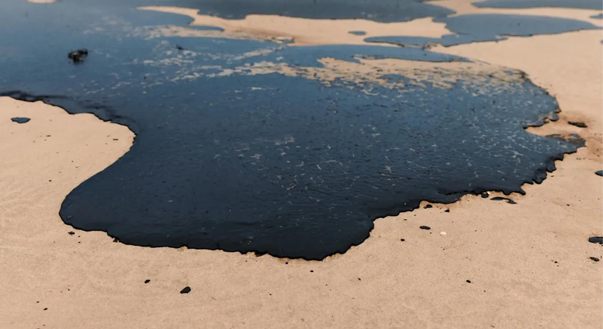
Authorities said the oil slick is drifting northeast and could travel roughly 121 kilometres within the next two days, although its movement will depend on prevailing sea and weather conditions.
Oil spill detected off Oman after tanker runs aground near Hallaniyat Islands
Omani authorities have confirmed that an oil spill has occurred in the country’s territorial waters after a tanker became grounded near the Al Hallaniyat Islands in Dhofar Governorate.
Officials are continuing to monitor the situation and have begun measures aimed at containing the spill and preventing the affected area from expanding further.
The incident has prompted increased surveillance of the waters surrounding the islands as authorities assess the movement and extent of the oil on the sea surface.
According to information released by the authorities, monitoring operations detected an oil slick moving in a northeasterly direction from the Hallaniyat Islands towards Oman’s mainland coastline.
The slick was observed approaching the coast, with the nearest detected point estimated to be approximately seven kilometres from the mainland.
Authorities are closely tracking the movement of the oil because its direction and rate of spread can change depending on conditions at sea and in the atmosphere.
Oil remains on the surface
The spill has so far remained on the surface of the sea, where it continues to move and change in shape.
Officials said the slick is being influenced by prevailing marine and atmospheric conditions, which can affect its trajectory and determine how quickly it disperses or expands.
Changes in wind direction, currents, wave conditions and other environmental factors can cause an oil slick to move away from its original location.
For this reason, authorities are maintaining surveillance of the affected waters to follow the slick’s progress and assess any potential impact on nearby coastal areas.
The monitoring operation is also intended to support response teams as they work to limit the spread of the spilled oil.
Tanker became grounded near the islands
The incident was first linked to the oil tanker Caroline Bezengi, which ran aground in waters near the Al Hallaniyat Islands.
On August 6, Oman’s Ministry of Transport, Communications and Information Technology, together with the Environment Authority, confirmed that the vessel had struck the seabed and become stuck in the area.
The grounding prompted authorities to assess the condition of the vessel and determine whether the incident had resulted in any environmental impact.
Subsequent surveillance identified the oil slick in the waters northeast of the islands, prompting continued monitoring and containment efforts.
The authorities’ response is focused on limiting the consequences of the spill and reducing the possibility of the oil reaching sensitive coastal areas.
Surveillance operations continue
Monitoring the affected waters is a key part of the ongoing response.
Authorities have been using surveillance to establish the direction in which the slick is moving and to determine how close it is getting to the mainland.
The latest observations indicated that the oil was travelling northeast from the Hallaniyat Islands.
The closest observed point was approximately seven kilometres from the mainland coast, making continued tracking particularly important.
Because the slick remains mobile, its position can change over time.
Authorities are therefore assessing the situation continuously rather than relying on a single observation of the spill.
Environmental conditions could affect movement
The behaviour of an oil slick at sea is influenced by a number of natural factors.
Marine currents can transport oil over significant distances, while wind can alter its direction and speed. Waves and other sea conditions can also change the shape and concentration of oil on the surface.
Atmospheric conditions may further influence the movement and dispersion of the slick.
This means the current location of the oil does not necessarily indicate where it will be several hours later.
Authorities are consequently keeping the area under observation to identify any changes in its trajectory.
The information collected through surveillance can help response teams determine where containment efforts should be concentrated and whether additional measures are required.
Focus on containing the spill
The Omani authorities have said work is under way to restrict the spread of the oil.
Containment is important because uncontrolled movement of a surface slick could increase the area potentially affected by the incident.
The response involves monitoring the oil’s position and movement while assessing the surrounding marine environment.
Officials are also expected to continue evaluating whether the slick is approaching coastal areas or environmentally sensitive locations.
The objective is to manage the incident as quickly as possible and reduce its potential impact.
Hallaniyat Islands location
The Al Hallaniyat Islands are located in Dhofar Governorate, off the southern coast of Oman.
The waters surrounding the islands are therefore being closely monitored following the grounding of the tanker.
The identification of an oil slick moving towards the mainland has increased the importance of ongoing surveillance.
The distance between the slick and the coastline can change depending on currents and weather conditions, making regular updates necessary.
Authorities are continuing to assess the situation to determine whether the oil remains offshore or moves closer to the coast.
Authorities coordinate response
The Ministry of Transport, Communications and Information Technology and the Environment Authority are involved in the response to the incident.
Their involvement reflects the need for coordination between agencies responsible for maritime activity and environmental protection.
A vessel grounding can create a range of potential concerns, including damage to the ship, leakage of oil or other materials and possible effects on marine ecosystems.
The environmental authorities therefore have an important role in assessing the impact of the spill and supporting measures aimed at protecting coastal and marine areas.
Importance of continued monitoring
Although the spill remains offshore, its movement is being carefully watched because the slick has been detected moving towards the mainland.
The reported distance of around seven kilometres from the nearest point of the coast makes the direction of movement particularly significant.
Officials need to determine whether the oil will continue towards land or whether changes in currents and atmospheric conditions will redirect or disperse it.
Regular surveillance allows authorities to respond to those changes more effectively.
The vessel at the centre of the incident
The Caroline Bezengi tanker became grounded in the area near the Hallaniyat Islands, according to the Omani authorities.
The vessel reportedly struck the seabed and became stuck on August 6.
Following the incident, authorities began assessing the situation and monitoring the surrounding waters.
The subsequent detection of the oil slick confirmed that the grounding had resulted in an oil spill in Omani waters.
Officials are now focused on managing the environmental consequences and preventing the slick from spreading further.
What happens next
The immediate priority remains tracking the oil and limiting its movement.
Because the slick is being affected by marine and atmospheric conditions, authorities will need to continue monitoring it over the coming period.
The location, size and direction of the slick may change as weather and sea conditions evolve.
Further surveillance will therefore help officials determine whether containment measures are succeeding and whether the oil is moving towards or away from the mainland.
The response may also provide authorities with a clearer picture of the environmental impact of the incident.
Public safety remains under observation
Authorities are continuing to assess the situation while monitoring the spill and working to control its spread.
The movement of the slick towards the mainland has made surveillance of the coastal area an important part of the response.
Officials will be able to evaluate any potential risks as more information becomes available from monitoring operations.
For now, the focus is on managing the spill at sea, tracking its movement and preventing the affected area from becoming larger.
Ongoing assessment of marine impact
An oil spill can have implications for marine and coastal environments, particularly if petroleum products reach sensitive ecosystems.
The authorities’ continued surveillance will therefore be important in determining whether the slick approaches any environmentally vulnerable areas.
The location of the Hallaniyat Islands and their surrounding waters makes the monitoring operation particularly significant.
By identifying changes in the slick’s direction and extent, response teams can better assess the potential consequences and determine where intervention may be required.
Authorities continue efforts to control the situation
Oman is continuing its response after the tanker grounding near the Al Hallaniyat Islands resulted in an oil spill.
The slick has been observed moving northeast towards the mainland, with the closest reported point around seven kilometres from the coast.
At present, the oil remains on the surface and continues to shift in response to marine and atmospheric conditions.
Authorities are maintaining surveillance while carrying out efforts to limit its spread.
The incident follows the August 6 confirmation from the Ministry of Transport, Communications and Information Technology and the Environment Authority that the Caroline Bezengi had struck the seabed and become grounded in the area.
With the oil still moving, authorities are expected to continue monitoring the waters around the Hallaniyat Islands and the direction of the slick towards the mainland.
The coming period will be important in determining how the spill develops, particularly as weather, currents and other marine conditions change.
For now, officials remain focused on containing the incident, monitoring its environmental implications and taking measures to prevent the oil from spreading further across Oman’s coastal waters.
Tanker details and environmental concerns
The vessel involved in the incident has been identified as a crude oil carrier sailing under the flag of Cameroon, according to information available from MarineTraffic.
The tanker is reported to measure approximately 274.48 metres from bow to stern and around 48 metres across. Its size and the nature of its cargo have increased attention on the incident, particularly because the vessel became grounded near the Al Hallaniyat Islands and an oil slick was subsequently detected in the surrounding waters.
The grounding has raised environmental concerns because the waters around the islands support marine ecosystems that could potentially be affected by petroleum contamination.
Authorities are therefore continuing their response with two main priorities: reducing the environmental consequences of the spill and maintaining safe maritime movement in the affected area.
The marine environment around the islands requires close observation as the oil continues to move under the influence of natural conditions. Monitoring teams are assessing the slick’s direction, extent and concentration to determine how the situation is developing.
Oil slick continues to move
Authorities have been carrying out regular surveillance and analysing imagery to follow the movement of the pollution.
The latest monitoring indicates that the slick is continuing along a broadly similar trajectory. Based on the observations available so far, its overall extension has reached approximately 449 kilometres.
The reported figure refers to the observed extent of the pollution and should not be interpreted as the distance travelled by a single, concentrated body of oil.
The slick is currently moving towards the northeast, and forecasting models suggest that it could progress by approximately another 121 kilometres over the next 48 hours.
However, the projected movement is dependent on conditions in the sea and atmosphere. Changes in wind direction, current patterns, wave activity and other marine factors can alter the trajectory of an oil slick.
For this reason, authorities are continuing to update their assessment as new monitoring information becomes available.
Forecast is not the same as observation
Officials have stressed that the projected 121-kilometre movement should be understood as a scientific forecast rather than a direct observation of where the oil has already travelled.
Environmental forecasting systems use models to estimate how pollutants may move under anticipated conditions.
Such models are useful for planning response operations, but their projections can change when actual environmental conditions differ from those used in the calculations.
Wind speed and direction, ocean currents, waves and other factors can influence the movement and dispersion of oil at sea.
Consequently, the predicted path of the slick may change if weather or marine conditions shift.
Authorities are therefore treating the forecast as an indication of possible future movement rather than a definitive description of where the pollution will be located.
Continued surveillance remains necessary to compare the predicted trajectory with what is actually observed in the affected waters.
Potential movement towards Ras Madrakah
Analysis of the pollution pattern has also indicated that the thicker portions of the slick could move towards the entrances of Ras Madrakah.
This possibility has prompted authorities to maintain close observation of both marine waters and coastal areas in the region.
The focus on the thicker sections of the slick is important because the distribution of oil is not necessarily uniform across the entire affected area.
Some sections may contain a greater concentration of oil, while other portions may be more widely dispersed or thinner.
Tracking these differences can help authorities understand where the most concentrated pollution could potentially move.
The possibility of the slick approaching Ras Madrakah means that monitoring efforts will need to continue across a wider area.
Authorities can use updated imagery, environmental observations and modelling information to determine whether the pollution is maintaining its current course or changing direction.
The 390-square-kilometre figure
The latest analysis estimates that the oil pollution is currently spread across an area of approximately 390 square kilometres.
Authorities have clarified that this figure describes the geographical footprint where pollution has been detected or identified through the latest available data.
It should not be interpreted as an estimate of how much oil escaped from the tanker.
The size of an oil slick on the water cannot be directly converted into the volume of oil released without additional technical information.
This is because the same quantity of oil can occupy different surface areas depending on how thick the oil layer is and how extensively it has dispersed.
As petroleum spreads across the surface, its concentration can change considerably.
A slick can therefore cover a large geographical area even when the quantity of oil within a particular section is relatively thin.
Why slick size does not indicate spill volume
The relationship between the surface area covered by an oil slick and the amount of oil released is influenced by several variables.
One of the most important factors is the thickness of the oil layer.
A relatively thick layer of petroleum will occupy a different surface area from the same quantity of oil after it has become widely dispersed.
The physical characteristics of the oil itself also play a role.
Different types of petroleum products behave differently when exposed to seawater, wind, sunlight, waves and currents. Some may spread rapidly, while others may remain more concentrated for longer periods.
The degree of natural dispersion is another important consideration.
As the slick moves, wind and wave action can break the oil into smaller patches and distribute it across a broader section of the sea.
This process can significantly change the appearance and geographical footprint of the pollution.
Role of currents and winds
Ocean currents are another major factor influencing the location of an oil slick.
Currents can carry surface pollutants over considerable distances, potentially changing the position of the slick from one monitoring period to another.
Wind can also influence movement at the surface. Changes in wind direction or strength may push the slick in a different direction or alter its rate of movement.
The interaction between wind and currents can make the behaviour of an oil slick difficult to predict precisely over longer periods.
Wave conditions also contribute to the way oil spreads and breaks apart.
For these reasons, environmental specialists must consider multiple variables when estimating where the pollution could move.
Natural dispersion changes the shape of the slick
The shape and appearance of the oil pollution are not expected to remain constant.
As the slick moves across the sea, it can spread outward, separate into smaller patches and become increasingly dispersed.
Natural processes can therefore cause substantial differences between observations taken at different times.
A monitoring image captured today may show a different pattern from one recorded several hours later, even if the overall quantity of oil has not changed significantly.
This is why authorities are relying on repeated monitoring rather than a single assessment.
Each new observation can provide information about the direction, geographical extent and changing characteristics of the pollution.
Continuous monitoring remains essential
Given the movement of the slick and the possibility that its trajectory could change, authorities are continuing to monitor the affected waters.
Satellite or other imagery, combined with environmental data and analytical models, can help response teams follow developments.
The purpose of this monitoring is not only to determine where the oil is currently located but also to identify potential future areas of concern.
Particular attention is being paid to marine and coastal zones that could be affected if the slick changes direction.
The possible movement of thicker sections towards Ras Madrakah has added to the need for continued observation in the area.
Protecting marine ecosystems
The oil spill has raised concerns about the potential effect on the marine environment around the Al Hallaniyat Islands and surrounding waters.
Marine ecosystems can be sensitive to pollution, making rapid monitoring and response important after an oil release.
Authorities are therefore working to understand the scale and movement of the contamination while taking measures intended to minimise its environmental impact.
The response also has a maritime safety component.
Because the incident involves a grounded tanker and an oil slick moving through navigable waters, authorities need to consider the safety of vessels operating in the affected region.
Maintaining safe navigation while dealing with the environmental consequences adds another layer to the response effort.
Situation remains subject to change
Officials have emphasised that the current assessment represents a snapshot based on the latest available monitoring information.
The size, shape and position of the slick can change between observation periods.
Natural movement and dispersion may cause the pollution to spread across a larger area, divide into separate patches or shift away from its current location.
As environmental conditions evolve, forecasts may also be revised.
A change in wind direction or ocean currents, for example, could influence the projected northeastward movement.
This means the 121-kilometre forecast should not be regarded as a fixed outcome.
Instead, it provides authorities with an indication of one possible trajectory under the conditions considered by the forecasting model.
Further assessments expected
As monitoring continues, authorities are expected to gather additional information about the slick and its movement.
New observations can be compared with earlier data to determine whether the pollution is following the expected path.
This information can also help identify whether the concentration of oil is increasing or decreasing in particular areas.
The ongoing assessment will be important in determining the next steps in the response.
Particular attention will remain on areas that could potentially receive more concentrated sections of the slick.
The entrances of Ras Madrakah are among the areas being watched closely because modelling indicates that thicker portions of the pollution could move in that direction.
Understanding the latest figures
The figures released by authorities should therefore be viewed in their proper context.
The reported 449-kilometre extension describes the observed reach of the pollution and does not mean that the tanker released enough oil to form a continuous 449-kilometre-long slick.
Likewise, the approximately 390-square-kilometre figure represents the geographical area in which pollution was detected according to the latest analysis.
Neither figure alone provides a direct estimate of the volume of oil released.
Determining the quantity of spilled oil requires consideration of additional technical information, including the thickness and characteristics of the oil, the extent of dispersion and the environmental conditions affecting the slick.
Response focused on monitoring and safety
The ongoing response combines environmental observation with maritime safety measures.
Authorities are tracking the slick’s movement, assessing possible future pathways and monitoring coastal and marine areas that could potentially be affected.
At the same time, efforts are being made to maintain safe navigation in the region following the grounding of the tanker.
The situation requires continued coordination because the oil’s behaviour can change as conditions at sea evolve.
What authorities are watching now
The northeastward movement of the slick remains one of the main issues being monitored.
Forecasting indicates that the pollution could advance by around 121 kilometres during the following 48 hours, although that estimate remains dependent on marine and atmospheric conditions.
Officials are also watching the possibility that more concentrated sections of the oil could move towards the entrances of Ras Madrakah.
The surrounding coastal and marine areas will therefore remain under observation as new data is collected.
Ongoing environmental assessment
The incident demonstrates why the geographical footprint of an oil spill cannot be used on its own to determine its severity.
A slick can expand significantly as oil becomes thinner and more dispersed, while a smaller area can sometimes contain more concentrated pollution.
Environmental scientists therefore need to examine several characteristics before estimating the potential impact of a spill.
These include the nature of the oil, its thickness, how rapidly it is dispersing, the strength and direction of currents, wind conditions, wave activity and other marine factors.
As these variables change, the appearance and location of the slick can also change.
Monitoring will continue
Authorities are continuing to follow the oil spill near the Al Hallaniyat Islands after the Cameroon-flagged crude tanker became grounded in the area.
The vessel is reported to be approximately 274.48 metres long and 48 metres wide.
The latest monitoring has identified an oil slick extending over a broad geographical area and moving northeast.
While the observed extension has reached around 449 kilometres and the pollution has been detected across approximately 390 square kilometres, officials have made clear that these measurements should not be treated as estimates of the amount of oil released.
Forecast models indicate that the slick could move another 121 kilometres over the next 48 hours, but the actual trajectory will depend on changing weather and sea conditions.
The potential movement of thicker portions towards Ras Madrakah has prompted authorities to maintain intensive surveillance of nearby coastal and marine areas.
As the situation develops, the shape, size and location of the oil slick are expected to change naturally. Continued monitoring and updated analysis will therefore remain essential for assessing the environmental situation, supporting containment efforts and maintaining safe navigation in the affected waters.
Authorities say oil spill poses no immediate public safety risk
Omani authorities have reassured residents that the oil slick detected off the country’s coast does not currently present a threat to public safety.
Emergency response arrangements have been put in place to address possible developments and ensure that authorities are prepared to respond to different scenarios as the situation evolves.
Officials are maintaining close observation of the affected waters and are continuing to assess whether the movement of the oil could have any implications for coastal communities or important infrastructure.
Authorities have also sought to reassure the public that there is currently no reason for concern over essential facilities operating along the coastline.
These include desalination plants, fish farming operations and economic and tourism-related activities located in coastal areas.
Continuous seawater monitoring is being carried out as part of the response. The objective is to detect any changes in water quality and identify potential risks at an early stage.
The ongoing assessment allows specialists to determine whether the pollution is approaching areas where it could affect water supplies, aquaculture projects or other economically important activities.
Weather conditions create both challenges and advantages
The prevailing weather has presented authorities with a complicated set of circumstances.
On one hand, difficult marine conditions have made some technical aspects of responding to the spill more challenging. Stronger winds, waves and changing sea conditions can make operations involving vessels, divers and specialised equipment more difficult to conduct safely.
On the other hand, the same environmental conditions have contributed to moving portions of the oil away from Oman’s coastline.
This has helped reduce the possibility of direct contact between the slick and some coastal areas.
Authorities are therefore continuing to monitor weather and sea conditions closely, as changes in these factors can influence both the movement of the oil and the effectiveness of response operations.
The situation remains dynamic, meaning that current conditions may not necessarily remain the same in the coming days.
Multiple agencies involved in response
A number of Omani government bodies and national organisations are participating in the response to the incident.
Their work covers several areas, including addressing the oil leak, securing the grounded vessel, monitoring the affected waters and evaluating potential environmental consequences.
The response has been designed to reduce the risks associated with the spill while protecting marine ecosystems and maintaining safe navigation around the affected area.
Specialised national technical teams are using a combination of modern technologies and field-based assessments to build a clearer picture of the situation.
Satellite imagery is being used to track the location and development of the oil pollution, while environmental modelling helps specialists forecast possible movement under different weather and marine conditions.
Field inspections provide additional information that cannot be obtained from remote monitoring alone.
By combining these sources, authorities can compare predicted movements with conditions observed directly at sea.
Identifying priority areas
The information collected through surveillance and environmental assessment is helping response teams determine which locations require the greatest attention.
Rather than treating the entire affected area in the same way, specialists can identify locations that may face a higher level of exposure or that contain particularly sensitive ecosystems.
This allows protective measures to be concentrated where they are considered most necessary.
The protection of biodiversity and marine habitats has been identified as a central priority.
Authorities are also working to identify environmentally sensitive locations that could be vulnerable if the oil changes direction or reaches coastal areas.
This approach is intended to reduce potential damage while ensuring that available resources are directed towards areas where they can have the greatest effect.
Protecting marine ecosystems
The waters around the Hallaniyat Islands contain a variety of marine habitats, making environmental protection an important part of the response.
Monitoring is being extended across sensitive locations, islands and areas of ecological importance.
Among the features being watched are coral reefs, marine habitats, turtle nesting grounds and coastal areas that have particular environmental value.
These ecosystems can be sensitive to changes in water quality and exposure to petroleum products.
For this reason, authorities are maintaining surveillance to determine whether any part of the oil slick is moving towards these locations.
The monitoring programme is intended to provide early warning of potential impacts and support decisions about where protective measures should be deployed.
Surveillance covers coastal and offshore areas
Environmental teams are not limiting their observations to the immediate location of the grounded tanker.
The response includes monitoring of offshore waters as well as coastal areas and islands that could potentially be affected by the movement of the slick.
This broad approach is necessary because oil can travel considerable distances under the influence of currents and winds.
The shape and concentration of the slick can also change as the pollution spreads and naturally disperses.
Continuous observation therefore gives authorities a better understanding of how the situation is developing.
Satellite data can provide a broad view of the pollution, while field teams can examine conditions directly and collect information from specific locations.
Work continues on the grounded vessel
In addition to dealing with the pollution in the water, technical teams are working to secure the tanker itself.
Authorities are investigating the source of the leak and assessing the condition of the vessel’s hull.
Maintaining the structural integrity of the ship is considered an important part of the operation because further deterioration could create additional environmental and maritime risks.
Specialist teams from the relevant ministry and other national organisations are working alongside technical experts from a specialised company.
Their combined efforts are focused on stabilising the situation and developing a safe method for dealing with the oil remaining inside the vessel.
Preventing further deterioration
One of the main objectives is to prevent the condition of the tanker from worsening.
A damaged or unstable vessel can present additional risks if its structure deteriorates or if more oil escapes into the surrounding waters.
Technical teams are therefore assessing the vessel and considering measures that could allow the remaining cargo to be handled safely.
The operation requires careful planning because any work on the grounded ship must take account of both environmental protection and maritime safety.
Plans to transfer the remaining cargo
Authorities are also working on technical solutions that would allow the oil cargo inside the tanker to be transferred safely.
Moving the cargo out of the vessel is an important step in reducing the potential for further leakage.
However, such an operation must be carried out under controlled conditions and with appropriate safety measures.
Specialists need to consider the condition of the hull, sea conditions, access to the vessel and the potential environmental consequences of the transfer.
Once the cargo has been safely removed, the longer-term plan is to address the grounded vessel and eventually salvage the ship.
All stages of the operation are expected to take into account maritime safety requirements.
Combination of aerial and marine operations
The response involves several types of field activity.
Aerial surveillance is being used to obtain a wider view of the affected waters and help identify changes in the position or appearance of the oil slick.
Marine operations are also taking place, including diving activities carried out by specialised personnel.
Divers can assess conditions around the vessel and provide technical information that may be difficult to obtain through surface observations.
Field monitoring is being conducted on an ongoing basis to complement satellite imagery and environmental modelling.
The combination of these methods allows authorities to develop a more complete understanding of both the environmental situation and the condition of the tanker.
Technical solutions being developed
Because the incident involves a grounded crude oil tanker, the response requires specialised technical expertise.
Authorities are assessing different options for dealing with the remaining oil cargo while attempting to minimise additional environmental risks.
The objective is to find a method that protects personnel, maintains the stability of the vessel and limits the possibility of further pollution.
Technical assessments will continue as conditions change.
The final approach may depend on factors including the vessel’s condition, sea conditions, accessibility and the location of the remaining cargo.
Official updates to continue
The Environment Authority has said it will continue providing official information as the situation develops.
Updates will be based on the latest documented technical findings and observations available to the authorities.
This approach is intended to ensure that information provided to residents, businesses and the media remains accurate and reflects the latest verified assessment.
The authority has also urged the public to rely on official sources rather than circulating unverified information.
This includes avoiding the sharing of unofficial estimates, maps or figures relating to the size of the spill, its movement or the quantity of oil released.
Distinguishing observations from forecasts
Officials have highlighted the importance of understanding the difference between information that has been directly observed and projections generated by environmental models.
Actual monitoring data provides information about what authorities have detected at a particular time and location.
Modelling, by contrast, is used to estimate how the oil could behave under certain environmental conditions.
Forecasts can change if wind, currents, waves or other marine factors change.
As a result, a projected path should not automatically be treated as a confirmed future location of the slick.
The authority is therefore encouraging the public and media to distinguish between verified observations and model-based scenarios.
No final estimate of spilled oil yet
Authorities have also stressed that figures circulating about the quantity of oil released should not be considered official unless they are supported by a documented technical assessment.
The geographical size of an oil slick does not provide a direct calculation of the volume of petroleum that entered the sea.
Several factors influence the relationship between the visible area of pollution and the quantity of oil present.
These include the thickness of the oil layer, the physical properties of the petroleum, the extent of natural dispersion and the influence of wind and ocean currents.
Consequently, any estimate of the amount spilled needs to be based on detailed technical analysis rather than simply measuring the area covered by the slick.
Importance of the Hallaniyat Islands
The environmental focus of the response is particularly significant because of the ecological characteristics of the Al Hallaniyat Islands.
The island group consists of five remote islands located approximately 40 kilometres off Oman’s southeastern coastline in the Arabian Sea.
The islands are known for their relatively undisturbed natural environment and rich marine ecosystems.
Al Hallaniyah is the largest island in the group and is the only one that is inhabited.
It has become known as a destination for visitors interested in nature and marine environments, with the area supporting a range of wildlife and coastal habitats.
Rich marine biodiversity
The waters and coastline around the islands contain diverse marine life.
Coral reefs, fish populations and sea turtles are among the ecological features associated with the islands.
The beaches also provide important nesting areas for turtles, while the surrounding waters support a variety of marine species.
Dolphins and whales can also be observed in the region, adding to the area’s ecological importance.
The combination of coastal and marine habitats makes the islands particularly valuable from a conservation perspective.
Proposed nature reserve status
The Hallaniyat Islands have also been proposed for designation as a nature reserve through UNESCO-related conservation efforts.
The objective is to protect important ecological features while supporting the sustainable use of natural resources.
Among the conservation priorities are turtle nesting beaches, coral reef systems and bird habitats.
The proposal also recognises the importance of maintaining fish resources in a way that allows for sustainable use.
The islands’ environmental significance has therefore been recognised beyond their value as a local tourism destination.
Important habitat for sea turtles
Turtle nesting is one of the ecological characteristics that makes the islands significant.
Several beaches provide locations where turtles come ashore to lay their eggs.
Protecting these nesting areas is an important part of conservation efforts because disturbance or pollution can affect the conditions required for successful nesting.
The monitoring of the oil spill therefore includes attention to coastal areas where turtles may breed.
If pollution were to reach these areas, authorities would need to assess the potential consequences and determine appropriate protective measures.
Coral reefs and marine life
Coral reefs around the islands also contribute to their ecological importance.
Reef systems provide habitat for a wide range of marine organisms and support fish populations.
They can also be vulnerable to environmental disturbances, making the monitoring of offshore waters particularly important during an oil spill.
Authorities are therefore keeping marine habitats under observation as part of the broader environmental response.
The aim is to identify any potential exposure and take appropriate action if necessary.
Important bird habitats
The Hallaniyat Islands are also notable for their seabird populations.
Several bird species use the islands for nesting and breeding, making the area an important habitat for avian wildlife.
The islands are particularly significant for the Masked Booby, which is reported to have nesting sites there that are unique within Oman and the wider Arabian Sea region.
Other species found in the area include the Socotra Cormorant, Sooty Gull and Bridled Tern.
The Socotra Cormorant is especially notable because the Hallaniyat Islands are considered its only breeding location in Oman.
Protecting seabird populations
The availability of suitable nesting areas and food sources makes the islands valuable for seabird populations.
Birds rely on both the islands and surrounding marine environment for survival, meaning an environmental incident at sea could potentially affect more than one part of the ecosystem.
Monitoring therefore extends beyond the immediate oil slick to include coastal habitats and areas used by wildlife.
Authorities are continuing to assess the situation to ensure that sensitive ecological areas receive appropriate attention.
Balancing environmental protection and maritime safety
The response to the tanker incident involves a delicate balance between protecting the environment and ensuring that technical operations can be conducted safely.
The grounded ship must be stabilised and its remaining cargo managed, while response teams also need to prevent further pollution.
At the same time, maritime traffic in the area must be managed carefully to minimise additional risks.
Weather and sea conditions can make these operations more complicated, meaning technical teams must continually assess whether conditions are suitable for particular activities.
Continued monitoring remains essential
The situation around the Hallaniyat Islands remains under close observation.
Authorities are using aerial surveys, satellite imagery, field inspections, diving operations and environmental models to track developments.
The information gathered through these methods will help determine whether the slick is changing direction, becoming more dispersed or approaching environmentally sensitive areas.
It will also assist technical teams working on the tanker itself.
Public urged to follow verified information
With the incident continuing to develop, authorities have called on the public and media to rely on official announcements for information.
Unverified figures, maps and predictions can create confusion, particularly when dealing with a spill whose size and location may change between monitoring periods.
Official information will continue to be updated as new technical assessments become available.
The distinction between confirmed observations and forecasts is particularly important because environmental models are subject to changing conditions.
Protecting Oman’s marine environment
The response ultimately aims to minimise the impact of the oil spill on Oman’s marine and coastal environment.
The Hallaniyat Islands’ combination of coral reefs, turtle nesting beaches, seabird habitats and diverse marine life makes environmental protection a major consideration.
At the same time, authorities are working to secure the tanker, identify the source of the leak and safely manage the oil remaining inside the vessel.
Technical specialists are developing solutions for transferring the cargo before the vessel can eventually be salvaged.
These efforts are being carried out alongside continued environmental monitoring and maritime safety operations.
For now, officials say the spill does not pose a public safety threat, while emergency arrangements remain active to address potential developments.
The combination of continuous seawater testing, environmental surveillance, vessel inspections and modelling is intended to provide authorities with the information needed to respond effectively.
As conditions at sea change, the authorities will continue reviewing the situation and updating their response accordingly.
The wider objective remains to prevent further pollution, protect sensitive marine and coastal habitats, safeguard important infrastructure and maintain safe navigation while the operation to secure and eventually remove the grounded tanker continues.